Kurkijoki Parish
Written by Antti Laukkanen; Internet-form by Mauri Rastas, 17.03.2008
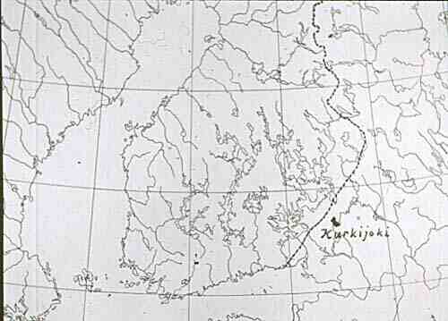
1. Location and size
|
Kurkijoki parish was located in central part of former Finnish Karelia in the shores of Lake Ladoga and in between the towns of Käkisalmi (Swedish: Kexholm) and Sortavala (Swedish: Sordavala). The distance from central parts of the parish to Käkisalmi was about 40 km (25 mi), to Sortavala about 50 km (35 mi) and to Viipuri (Swedish: Vyborg) about 100 km (60 mi). The neighboring parishes were - beginning from southwest and clockwise - Hiitola, Parikkala, Jaakkima and Lumivaara.
Kurkijoki was elongated and located in the southwest-northeast direction; the distance from open Ladoga to border of Parikkala was about 35 km (20 mi) width being round 15-20 km (9-12 mi). The total area of Kurkijoki was about 537 sq. km (207 sq. mi).
|
2. Surface profile and nature
The area of Kurkijoki divides into two rather different kinds of surface profile and soil, coastal area and inland. Characteristics in both belts have strongly been moulded by the Ice Age.
The northwestern and nothern parts of Ladogan coasts are very deep and broken by long, fjord-like inlets beginning from Hiitola (the same appears in the lakes and valleys in the area). It has to be assumed that the enormous masses of ice, which have moved exactly in the mentioned direction, have had their effect on on the direction of inlets as well as on the surface profile in common.
The central parish village Lopotti (derived from Russian word sloboda, meaning market place) was located at the end of a 12 km (8 mi) long fjord. A fjord about as long is located in the border of Hiitola and Kurkijoki and some shorter ones in Tervu village and in the border of Lumivaara. In that area there is also a distinctive 3 km (2 mi) long fjord called Kiiskansalmi. It is here and there only 30 m (100 ft) wide, surrounded by craggy cliffs and a real place of natural beauty. The coastline is bounded with an archipelago with a great number of variable islands. Bare and craggy cliffs are typical in this area as well as wide and low valleys. The variety of terrain and exuberance of plants along with the rich shapes of waterline make those sceneries unforgettable.
There are only a few little lakes in the area of Kurkijoki. Instead of that there are lots of little ponds in moorland area of the inland some of them having sceneries of natural beauty surrounding them. The rivers are also small and in most cases originate from the parish area. The river that gave its name for Kurkijoki (Crane River) is only a 1/2 km (1/4 mi) long mouth of two rivers joining together before reaching Laikkalanlahti bay in Lake Ladoga.
3. A little bit of History
According to many researchers of Karelian history the original home of whole Karelian tribe has lain in the Ladogan coast and Käkisalmi-Kurkijoki area. Already in the year 1000 a rich Karelian tribe lived there under lead of their chiefs. Many "castle mountains" are memories from that era and many findings from the Iron Age prove that, too. From this area the population spread into wide wilds of west and north. It is actually known that the Karelians have lived in the area since the Ice Age had passed.
After Pähkinäsaari peace treaty in 1323 the province of Käkisalmi, which included Kurkijoki, was left in sphere of control of Novgorod and Greek Orthodox Church. Kurkijoki pogost (orthodox church parish) was one of the administrative territories in the province and included hundreds of "smokes" (houses) even in the inland area. The area was very large covering for example the later parishes of Parikkala and Jaakkima. In 1570 Sweden and Russia, Novgorod's inheritant, began a long era filled with wars and during this time the Kurkijoki pogost was incorporated into Sweden. The peace treaty of Stolbova ended that season in 1617. Sweden got hold of Käkisalmi province, Ingria and wide areas from the Northern side of Ladoga.
The Swedes began a missionary of converting the areas to Lutheran religion. That led into great dissatisfaction among original inhabitants of the area. Many of them moved east and many new inhabitants who weren't satisfied with the Swedish taxes or were supposed to join the military forces escaped into these areas which were demilitarized at the time and offered tax exemptions. During Swedish-Russian war in the middle of 17th century a majority of population in Kurkijoki moved into area of Tver in Russia with the Russian forces. Lots of people moved into the deserted farms and houses mainly from West, parishes of Jääski and Savolax.
In 1651 queen Kristina donated Kurkijoki as an enfeoffment to Ture Oxenstierna, who founded town of Kronoborg in Lopotti in 1658. That town was quite remarkable on its time. In the late 17th century there lived over 100 burgesses and over 500 inhabitants. Russians destroyed this boom town in 1710. A golden crown remembers of the town Kronoborg in the shield of Kurkijoki.
After that Kurkijoki once again was under Russian power and that was officially confirmed in the peace treaty of Uusikaupunki in 1721. During the following season the former yeomen were forced to work hard for courts. That continued even after so called Old Finland (including Käkisalmi parish and Kurkijoki) was incorporated into Grand Duchy of Finland in 1812. The state of Finland redeemed the lands and farms from courts in 1860s and 1870s and the farmers got hold of their farms again with long times of payment. In 1917 Kurkijoki became a part of independent Finland.
Before Winter War (Finno-Russian war 1939-1940) Kurkijoki had over 10000 inhabitants of which 60 were Swedish speaking having their own village and school. Some 350 of the population were Greek Orthodox who mostly lived in coastal villages. In addition to Lutheran Church there was also a Greek Orthodox Church in Lopotti area.
The parish had 37 villages which of Tervu was the largest. Railway had been built during 1890s and a big crossing station was built in Elisenvaara which had grown into a large village afterwards. Trains from Elisenvaara left for four directions: Viipuri, Lappeenranta, Savonlinna and Sortavala. Elisenvaara was the biggest village by inhabitants.
November 30th 1939 Soviet Union attacked Finland by false causes and after 105 days of Winter War, Eastern part of Karelia was ceded to it. Over 400000 people had to leave their homes and move into new areas. So called Continuation War took place in 1941-1944 and the Finns were able to conquer back their lost territories. Lots of the inhabitants returned to Kurkijoki, too, and tried to begin a new life although the nation was still in war. In autumn 1944 Finland had to make peace with Soviet Union again and the areas were once again ceded to the attacker despite of the fact that they never managed to break the Finnish lines in the area. The people of Karelia and Kurkijoki had to leave their homes again and at least until today it has been final.
After Soviet Union disappeared from the World Map, people have been able to visit their places of home, which were totally closed for almost 45 years. Most of the farms and houses have disappeared and the area is in many ways in horrible condition. But the shape of nature and the beautiful sceneries still exist for times to be.
beginning of the page |
frontpage | (a larger
history of Karelia)